
Beschrijving
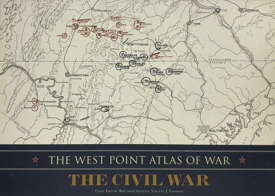
The West Point Atlas of War: The Civil War, originally published in 1959 as part of a set on American wars and later issued as a standalone volume, is a richly detailed campaign atlas designed for pedagogical use at West Point. The 1962 Praeger edition includes approximately 154 color maps, each paired with explanatory text, offering a dynamic and visual representation of the nineteen major campaigns of the Civil War.
This atlas pioneered the format of combining one-day (sometimes hour-by-hour) map sequences with adjacent narrative, allowing learners to trace troop movements, tactics, and strategies in real time. The clarity is enhanced through the use of color-coded symbols, annotated unit strengths, battle lines, fortifications, and geographic markers, making it an invaluable teaching tool for understanding both operational flow and campaign progression.
While esteemed for its historical and instructional value, particularly for cadet education, the West Point battle-map style has limitations. Critics note that in its focus on tactical combat it often omits broader campaign logistics, reserve dispositions, roads, and support elements—making it less effective for observers seeking a holistic view of war beyond battlefield engagement. Nonetheless, it remains a benchmark reference for military historians and enthusiasts thanks to its visual clarity and operational fidelity.


Beoordelingen
Er zijn nog geen beoordelingen.